Saturday, September 24, 2016

The Garden Wall II


Jessica Stickseed (Hackelia micrantha).

Other delightful surprises kept showing up along the trail: blue forget-me-not like flowers (Hackelia micrantha), a wild clematis with drooping blue flowers (Clematis occidentalis), so many other flowers that I couldn't begin to guess at! I wish I could have had an expert botanist with me, I'm sure one could have pointed out so much more than I could take in.

Native clematis (Clematis occidentalis)

Along the trail.

Mountain Death Camas (Anticlea elegans)


Going to the Sun Road below the trail.

As the trail wound around thickets of subalpine firs and some very steep hillsides, it was now several hundred feet above the Going to the Sun Road. The lush vegetation of the Garden Wall began to thin out and become more like grassland. Fields of bear grass in bloom dotted the slopes.


Looking towards Haystack Butte.

Looking down a chute.

looking toward Haystack Butte.

I hadn't encountered any hikers for a while, and it had stopped raining when I turned around and saw this tiny creature on the trail right behind me. I'm still trying to figure if it was a Pika, a small mammal that inhabits high-altitude meadows in the Rockies, or a baby chipmunk or vole of some sort (the coloring looks much like a chipmunk but it's lacking the characteristic stripes).

A tiny inhabitant of the Highline Trail.
Pika or chipmunk?

I held still while the tiny-eared creature grazed on the vegetation around the trail briefly and then disappeared into the brush. I gazed at my watch--it was getting towards four o'clock. I had intended to reach Haystack Falls before turning back, but I needed to turn around now to get back in time to return my rental car before they closed at six.

Looking up.

Reluctantly I turned back. Other hikers returning from Haystack Falls passed me. I stopped now and then to take more photos.

Wildflowers on the Garden Wall.

Wild onion (Allium schoenoprasum)

This was the last photo I took before my camera froze up. The shutter would not focus or shoot, and when I tried to see the other photos I had taken, it would not change modes. Oh-no!  What was I going to do without a camera, and this early into my trip? I had two weeks ahead at Sperry Chalet--how was I going to get the photos I needed? How could I have been so stupid? 

Well, there was nothing I could do for now. Perhaps when the camera dried out it would go back to normal, or I could find a store in Columbia Falls where I could get it fixed quickly. But on a Saturday evening, the chances were slim. I passed a couple of Japanese tourists with very fancy camera rigs and was tempted to offer to buy one of their cameras, but they didn't understand enough English for me to even try.

I trudged on back towards my car. At least I'd gotten the hang of using the poles and my stride didn't feel so awkward as at the beginning of the hike. I drove back to the car rental place to call Kevin as prearranged. I explained the situation with my camera but he said he didn't know of any camera repair shop in town--there wasn't any store where I could make a quick purchase either. My only hope was to pray that the camera would dry overnight and work again.

That evening I tried to think of alternatives if the camera didn't go back to normal the next day. I called Herb and he thought perhaps he could buy me another camera the next day and ship it to Kevin overnight, and Kevin could send it up with the next mule train that would resupply the chalet in another few days. I fell asleep praying this wouldn't be necessary...

Sunday, September 18, 2016

The Garden Wall I

Mt. Oberlin in clouds.

I woke to the sound of rain, got up to look outside, and yes, it was pouring out there! I lingered over breakfast hoping the weather would clear up later on. Kevin stopped by and I gave him my three duffel bags and portfolio for tomorrow's mule pack train.

While waiting for the weather to improve, I caught up with my Email on the hotel's computer. Getting on towards ten, the rain stopped and it seemed to be clearing. Today might be the perfect day to hike at the Garden Wall, with the plants fresh after the rain.

It would be chilly up there, so I put on every layer of clothing I had kept (everything else was in the duffels I'd given Kevin earlier), and unpacked my new hiking poles. This would be a good time to get the hang of using them, in preparation for the grueling hike to Sperry Chalet tomorrow. I bought a sandwich at a carry-out along the way and drove up towards Logan Pass.

Driving up to Logan Pass

The clouds played hide-and-seek with the mountains, and today the Weeping Wall was a veritable torrent. With fewer hikers and tourists out, there were plenty of parking places at the Visitors Center at Logan Pass. I ate half my sandwich in the car and then suited up for the trail. The Highline Trail, as it's called, begins at a meadow on the other side of the road by the parking lot at Logan Pass. It crosses a steep talus slope and then the trail continues above the Going to the Sun Road, which gradually drops down. All along this stretch the Highline trail is visible as a ledge running parallel several hundred feet above the road.

Looking down from the Highline Trail.

I steeled my nerves to look down from this precarious ledge to the road below, trying to reassure myself that my hiking poles would hold me steady. It was so narrow it would have been difficult to pass another person at this spot. 

The beginning of the Garden Wall

Once past this, the beginning of the Garden Wall was marked by rills periodically cascading down from the heights above and a profusion of plants unlike anything I'd ever seen. Plants grew anywhere the terrain gave them any kind of purchase.

Rocky Mountain Columbines (Aquilegia flavescens) under a ledge.
Black Twinberry (Lonicera involucrata)

I passed a lovely clump of Rocky Mountain Columbines (Aquilegia flavescens) growing under a moist ledge. Further on a golden twin flower covered by a purplish bract peeked out under a shrub, which I learned later was a native honeysuckle called Bearberrry or Black Twinberry (Lonicera involucrata).

Arctic Willow (Salix arctica)

Looking across the valley.

As I walked along I alternated between looking down at the plants and the spectacular views across the valley. The sun almost broke out once and then a veil moved across-- a steady rain started.


Rain moving in.

The Garden Wall

I pulled up the hood of my parka under my hat, and managed to keep fairly dry, but after a while my wool Tilley hat became completely soaked and droplets began to drip off the edge of the brim whenever I leaned over to look at or photograph the plants. I tried to keep my camera dry but it was almost impossible.

Mist on the Garden Wall.

In places the rocky ledge the trail ran on widened a bit and subalpine firs grew, giving some shelter from the wind. An incredible variety of species took advantage of the shelter--it truly seemed like a spring garden here.

Bracted Lousewort buds (Pedicularis bracteosa).

Twisted-Stalk (Streptopus amplexiflolius)

So many of the plants were completely new to me, though there were some I could guess at--these plants had eastern relatives that I was familiar with, or they were the native versions of cultivated garden plants--like Spirea, that I was well-acquainted with. Others, like the Bracted Lousewort, I had seen before on previous trips through the Rocky Mountains.

The leaves of the one above, Twisted-Stalk, looked very like Solomon's Seal, but the flowers were quite different. Some, like the False Solomon's Seal below, or the False Hellebore or Corn Lily (Veratum viride) seemed to be the same species that are also found in the east.

False Solomon's Seal (Maiamthemum racemosa) and blue Stickseed.

Monday, September 12, 2016

Many Glacier

Driving towards Many Glacier.

The road leading to the Many Glacier area parallels another lake, Lake Sherburne, and crosses areas of private land where cattle seemed to graze freely. Masses of lupines and other wild flowers dotted the banks of the lake, much as near St. Mary's.

Lupines and wildflowers on the banks of Lake Sherburne
Many Glacier Road.

The Many Glacier part of the park is directly behind the mountain range with the Bishop's Cap, and is not visible from the Going to the Sun Road. It's difficult to get an idea of how the two sides connect with each other when viewed from such a different perspective until one looks at a map. The roadsides along the way were like a garden of wildflowers, so many varieties!

Bee balm (Monarda fistulosa) with wild pink Geraniums (Geranium viscosissimum), white yarrow and asters.

Wildflowers on the road to Many Glacier.

The road ended at a small lake named Swiftcurrent Lake, with the Many Glacier Hotel on its eastern edge. There was a campground on the shore opposite the hotel, and a few people were fishing and canoeing on the lake. The historic hotel also dates from 1915, but I didn't go inside to take a peek.

Swiftcurrent Lake and the Many Glacier Hotel.

The afternoon was waning and I was supposed to meet Kevin and his lady business partner for dinner in the evening, so I didn't linger here very long. There was so much to explore in Many Glacier, it would have been nice to spend at least one entire day here, but with such a long drive back, it was time to turn around.

Triple Divide Peak way in the distance.

On the return trip I stopped at one pull-off at St. Mary Lake with a plaque that pointed out Triple Divide Peak way off in the distance (the tiny peak to the left seen thru the two closer mountains), and explained the origin of its name. The waters from its western slope drained into the Pacific Ocean, the ones on the east slope into the Missouri River and eventually into the Gulf of Mexico, and the north slope drained into the Canadian Hudson River Basin. Awesome!

I stopped at Siyeh Bend once more, to photograph flowers I had missed in the morning and was spotting now in the afternoon light. From this angle, the waterfall below Reynold Peak was lovely, and the east side tunnel carved through the rock carrying the Going to the Sun Road looked even more impressive.

Waterfalls below Reynolds Mountain from Siyeh Bend and east side tunnel.
Siyeh Bend and creek
Cascade Mountain Ash (Sorbus scopulina)
Thimbleberry (Rubus parviflorus)

Lyall's Pentstemon, Indian Paintbrush and Thimbleberry.

I spotted more flowers above Siyeh Bend and stopped again for Rocky Mountain Columbines.

Rocky Mountain columbine (Aquilegia flavescens)

I found a parking spot at one of the pull-offs at Logan Pass and stopped again for more photos of mountain goats and plants. I wanted to photograph the expanses of bear grass growing along the way, looking for the best examples for my paintings.

Prickly currant (Ribes lacustre)


Bear grass at Haystack Falls

After going around the Loop and down, I found parking at the Trail of Cedars on Avalanche Creek, and decided I had just enough time left for a short investigation.


Trail of Cedars

The Trail of Cedars consisted of a boardwalk set above the floor of a thick forest of western cedar, Douglas fir and Lodgepole pine, a typical vegetation of northwestern Pacific forests. I saw plants on the forest floor that seemed familiar, some had leaves that looked like orchids (I saw these in bloom in another location and they were actually Clintonia uniflora), another I am sure was corn lily (Verratum viride).

Leaves of Clintonia uniflora, false Solomon's seal (Maianthemum stellatum or racemosum) and corn lily (Verratum viride) with ferns on the forest floor.

A plant with nasty thorns was appropriately named Devils club, as I learned later. Although the berries look attractive, I understand the spines, which also grow under the leaves as well as on the stems, break off easily and can embed themselves in the skin, causing grave irritation and allergic reaction.

Devil's club (Oplopanax horridus)

At the midpoint of the short trail, a bridge crossed over Avalanche Creek; here was a sign for the trailhead to Avalanche Lake. It would have been a lovely warm-up hike if I'd had time, but unfortunately, it was now getting on towards six in the evening.

Avalanche Creek looking upstream.
Avalanche Creek looking downstreamm

Reluctantly I went over the bridge and back towards the road where I had parked. Perhaps tomorrow, I'd have time for Avalanche Lake? I needed to repack my gear tonight to have it ready for the mule pack going up to Sperry Chalet on Sunday morning. Kevin had asked me to have everything ready so he could pick it up tomorrow morning when he came by. He needed to have everything ready the night before, since the mule pack left around 5 AM the following day.

McDonald Creek above Avalanche Creek.

Sunday, September 4, 2016

Going to The Sun Road

Going to the Sun Road pull-out above The Loop.

After my first day on the shuttle, I wanted to reserve a spot on one of the famous Red Bus Tours, but all seats were sold out for the day. The only seat available was for the following day, a half day tour in the afternoon, which would take me only as far as Logan Pass, territory I'd already covered.

It seemed the only way to see the eastern side of the Continental Divide and the Many Glacier area was to drive myself there. So here I was on my third morning at Glacier, armed with camera and a bag lunch, driving up the Going to the Sun Road.

This road really is an amazing engineering feat: to think that they began building it in 1911 at a time when even if they'd had heavy machinery, it would have been impossible to move it up the mountains to the site. The crews that surveyed the route climbed about 3000 feet a day to accomplish their task and had to hang off the mountains on ropes and ladders to take measurements. The crews that built it camped on site during the short season and supplies moved on horse or mule back--no doubt about it, these people were truly tough. It took until 1933 to complete the road linking the two sides of the park, at a cost of about 2 million dollars. A restoration project completed recently cost over 180 million! Even today, plowing this road in the spring is not a job for the faint of heart.

I made it past "The Loop"--whew! All along the road there are pull-offs every so often where one can stop to gaze at the amazing views without endangering life and limb. There was such an immensity to look at!  The road was very narrow in places, and the oncoming traffic tended to veer off towards the middle to avoid the rock wall, while those going uphill tried to stay away from the low retaining wall at the edge of the precipice. Thank heaven most people took it slow, observing the 25 MPH speed limit.

Haystack Falls and Butte.

The Weeping Wall was to the left here, and immediately after, Haystack Falls-- I remembered that from the previous day. By mid-morning all the parking areas near the trailheads were full, and hikers were out everywhere in this gorgeous weather.

Going to the Sun Road looking down the valley.


Going to the Sun Road from Logan Pass.

The Parking lot at Logan Pass with the Red Buses.

At Logan Pass the parking lot was completely full, I had no choice but to drive on, and was lucky to find parking at Siyeh Bend, just below the pass on the east side of the Continental Divide. Here the roadsides were full of wildflowers: pentstemons (beard tongue) of two different colors, bear grass, paintbrush, a white-flowered crownvetch, too many varieties for me to identify at a glance. I took photos of the plants that caught my eye, hoping to be able to identify them later, once I'd had time to consult my books.

Siyeh Bend
Lyall's Pentstemon (Pentstemon lyallii).
Alberta Pentstemon (Pentstemon albertii)
Indian Paintbrush (Castilleja rhexifolia)

White Sweetvetch (Hedysarum sulphurescens)
Bear Grass (Xerophyllum tenax)

Siyeh Bend was still in the alpine zone, and many of the plants here were the same as those on the western side of the continental divide, though not all. As the road continued to descend, Mt. Jackson and its glacier came into view. The vegetation began to look different here, with aspens and lower elevation deciduous trees on drier slopes.

Mt. Jackson and Jackson Glacier

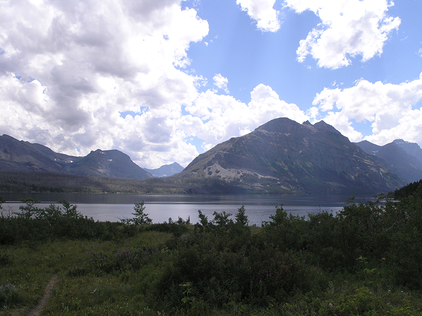
Eventually, Lake Saint Mary came into view. There was evidence of the previous year's fire and the associated succession of colonizing plants growing along its shores, with fireweed predominant. It was getting on towards one o'clock, and one of the pull-offs seemed like a wonderful spot to stop and have lunch.

Along the shore of Lake Saint Mary
Lake Saint Mary with Saint Mary and Virginia Falls on the opposite shore.
The lake, looking east towards Rising Sun and St. Mary's Village.

I lingered over my sandwich while surrounded by nature's beauty, watching a tour boat plying over the lake. After I'd finished, I turned back to see a long line of cars stopped in the middle of the road, with people hanging out the windows clicking away with cameras and videos. I asked a gentleman near me what was going on. "They've spotted a bear over there on the other side of the road," he said. I looked but didn't see anything, then suddenly a golden-backed bear appeared over the crest of the hillock, not fifty feet away!

Golden-backed black bear by Lake St., Mary.

I thought the bear could smell my lunch bag--they can pick up the smell of food miles away--was that what had attracted him? I ran towards my car (forgot that running in the presence of bears was a no-no) to dispose of my lunch bag quickly and grab my camera--I didn't want to miss this photo op! I managed to get a few shots of the bear before he ran off. In less than two minutes a park ranger showed up to investigate and break up the traffic jam, reminding folks that stopping was not allowed except at the designated pull-offs. Everyone moved on and my heart rate dropped back to normal. The ranger asked if I'd seen the bear, and I said yes, I thought it was a juvenile, but didn't know if it was a grizzly or a black bear--I'd never seen black bears of this golden hue before. The ranger told me that black bears in Glacier came in all different colors, from blonde like this one to very dark.

Beyond the lake the valley broadened and grassland became dominant. The valley floor was profuse with prairie-type wildflowers: masses of lupines, blanket flower, fleabane, wild roses, phlox and bee balm grew among the grasses.

Fields of wildflowers in east Glacier.

The line of cars in front of me stopped in the middle of the road again. I pulled over and asked what was up--it was another bear sighting, this one was quite far away. I got my binoculars out and spotted a big black bear feeding in the bushes at the base of the line of mountains. Another park ranger came by and dispersed the cars with the same reminder. It seemed bears were more numerous on this side of the park.

Wild rose (Rosa acicularis)
Blanket Flower (Gaillardia aristata)
Lupines (Lupinus sericeus)
Fleabane (Erigeron speciousus)

Another few miles without incident and I was at the east entrance of the park. To get to the Many Glacier area one has to leave the park and drive north on State Route 89 for a few miles, then turn left and re-enter the park on a different road.